The needs of the Western States of the US for weather, water and climate information is unique and strikingly different from the needs of the States in other regions of the country.
The Western States have historically relied on the Federal Government to provide the data collection and analytical capabilities to meet these needs. The Federal Government has simply failed to meet the evolving and critical needs of the Western US.
Our Mission is to form a strategic collection of Public Private Partnerships able to immediately provide the data and timely water and weather intelligence reporting needed to support effective decision making in every Western City, County and State.
W3IC is a 501 (c) 3 Non-Profit engineered to provide decision makers in Western States with timely and actionable weather, water and climate intelligence designed to assist in complex decision and policy formulation discussions.
Our Approach and one of W3IC’s primary innovations will be serving as the catalyst for and the creation of a vast array of over 30 separate and strategically located Gap Filling Weather Radars (GFWRs) throughout the Western States
The needs of the Western States of the US for weather, water and climate information is unique and strikingly different from the needs of the States in other regions of the country.
These needs are growing ever more acute and impactful.
The Western States have historically relied on the Federal Government to provide the data collection and analytical capabilities to meet these needs.
The Federal Government has simply failed to meet the evolving and critical needs of the Western US.
Not because of the hard work and talent of our River Forecast Centers nor the dedicated personnel manning our Weather Forecast Offices throughout the West, but rather by the sheer scope of the topic, limited by huge gaps in our federal data collection capabilities and complicated by confusion of missions and lack of applied budgets.
The economics of water, weather and climate now and in the future could mean billions of dollars of financial impact. Every dollar invested now may pay a hundred fold in returns in the years to come.
To address these acute and strikingly different needs, the Western States require a unique solution.
That solution is the Western Water & Weather Intelligence Center (W3IC). The needed approach – dozens of regional Public Private Partnerships (PPPs). The time for such an investment is now.
The W3IC is a 501 (c) 3 Non-Profit is engineered to provide decision makers in Western States with timely and actionable weather, water and climate intelligence designed to assist in complex decision and policy formulation discussions.
One of W3IC’s primary innovations will be serving as the catalyst for and the creation of a vast array of over 30 separate and strategically located Gap Filling Weather Radars (GFWRs).
Better measurement and management of Western States’ water assets is worth millions of dollars each year to a wide variety of users.
Better insights into the potential timing, location and intensity of flash floods would allow emergency managers to react more efficiently with their limited resources – saving more lives and property.
By providing hyper localized wind speed and direction forecasting, could help prevent a bad wild land fire from becoming a disastrous wild land fire, saving millions of dollars in additional costs, dozens of homes and additional lives. The Burn Scars from such disastrous fires can also lead to future water quality issues over dozens of square miles for years to come years after the fire has been put out
Better understanding and quantification of changing weather and trending climate patterns can support a larger number of competing participants to have difficult but informed conversations now – to address severe problems that are coming in just a few years.
The problem is not necessarily with the “volume of data” regarding weather, water and climate – but rather, with the “right data, from the right places and at the right time” – combined with a more sophisticated analysis of this new and existing data sources.
This could enable the production of true weather intelligence products tailored specifically for the Western Decision Maker.
W3IC is structured to perform four primary functions:
W3IC’s budget will be deployed less on facilities and more on a small diverse talent team and the deployment / maintenance of a diverse and strategically located array of physical water / weather data collection assets.
W3IC’s small diverse talent team will consist primarily of analytical personnel with backgrounds in the earth, hydrological and meteorological disciplines.
W3IC’s array of GFWRs will be augmented by a larger collection of physical water / weather data collection assets will consist primarily of stream gauges, “Super” SNOTEL Sites and Remote Weather Data Monitoring Systems.
Combined, W3IC will have access to significant amounts of critical data collected from critical gaps existing within existing local, state and national data collection systems / platforms.
This seamless data universe within the Western US will allow W3IC to produce hyper-localized water, weather and climate intelligence products other organizations are simply neither designed nor equipped to do.
It is envisioned thatW3IC will be comprised of a number of Public Private Partnerships (PPPs) funded and directed by a collection of sophisticated social impact investors; as well as, a number of Western States and Counties. This collection of PPPs will share the same understanding and vision of the critical aspects of water in the west and direct the larger mission of W3IC to provide more effective and timely forecasting and water / weather intelligence reports.
Due to the “line of sight” nature of the existing network of National Weather Service (NWS) radars, significant portions of the Western US, to include most of the Western Slope of Colorado, have little to no weather radar coverage below 25,000 ft MSL. Those radar “gaps” prevent accurate weather forecasting needed to predict:
80% of Colorado’s snowpack and water comes from the mountains that are poorly covered by existing NWS radars
The Colorado Division of Reclamation states that there are an estimated 23,000 abandoned mine shafts in Colorado. There may be as many as 500,000 abandoned throughout the Western US.
The natural process of rain fall and surface water leaching through the mine shaft create acids that leach heavy metals such as: Arsenic, mercury, cadmium and lead.
These heavy metals flow from the Mine Shaft and into local drainage systems, decimating nearly every living plant and water borne species it contacts.
The absence of any “Good Samaritan” legal underpinning has historically presented a barrier to addressing this issue. Western Water & Weather Intelligence Center is pursuing an approach that could reduce the impact of such leaching despite these current legal uncertainties.
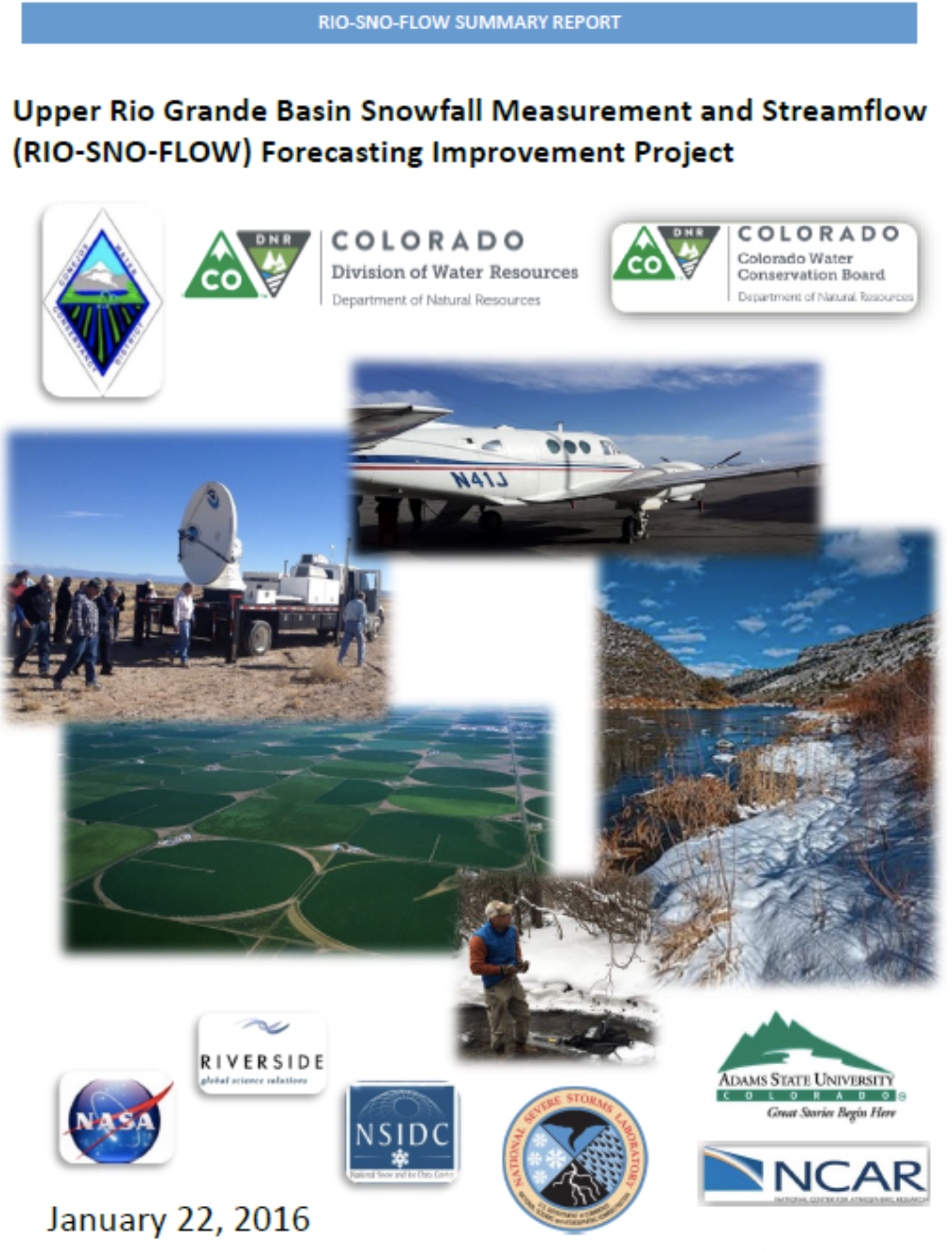
In January, 2016 the Colorado Water Conservation Board, in partnership with the National Center for Atmospheric Research (NCAR), NASA and other technical partners, published a study that indicated that by using portable weather radars to fill the gap in existing permanent weather radars coupled with better stream flow forecasting software from NCAR, significant improvements in forecasting stream flows generated year round by winter snow pack could be achieved, see fig. 36 below.
As encouraging as it was, this January, 2016 Report dealt only with the Upper Rio Grande River Basin in Southwest Colorado and for only one single year, thus referred to as a “Single Year – Single Basin” effort.
Our First Project will be a “Multi-Year Multi-Basin” effort. This project will be a 5-year effort to include:
We currently have the funding for our first radar to be installed along the Colorado River.
This Project is designed to: (a) duplicate and verify the findings of the original Single-Year Single-Basin study; as well as, (b) produce the Next Generation Stream Flow Forecasting Software Tool to enhance the accuracy in forecasting of stream flows critical to Western Colorado and it’s downstream users.
Excerpt from the January 2016 report:
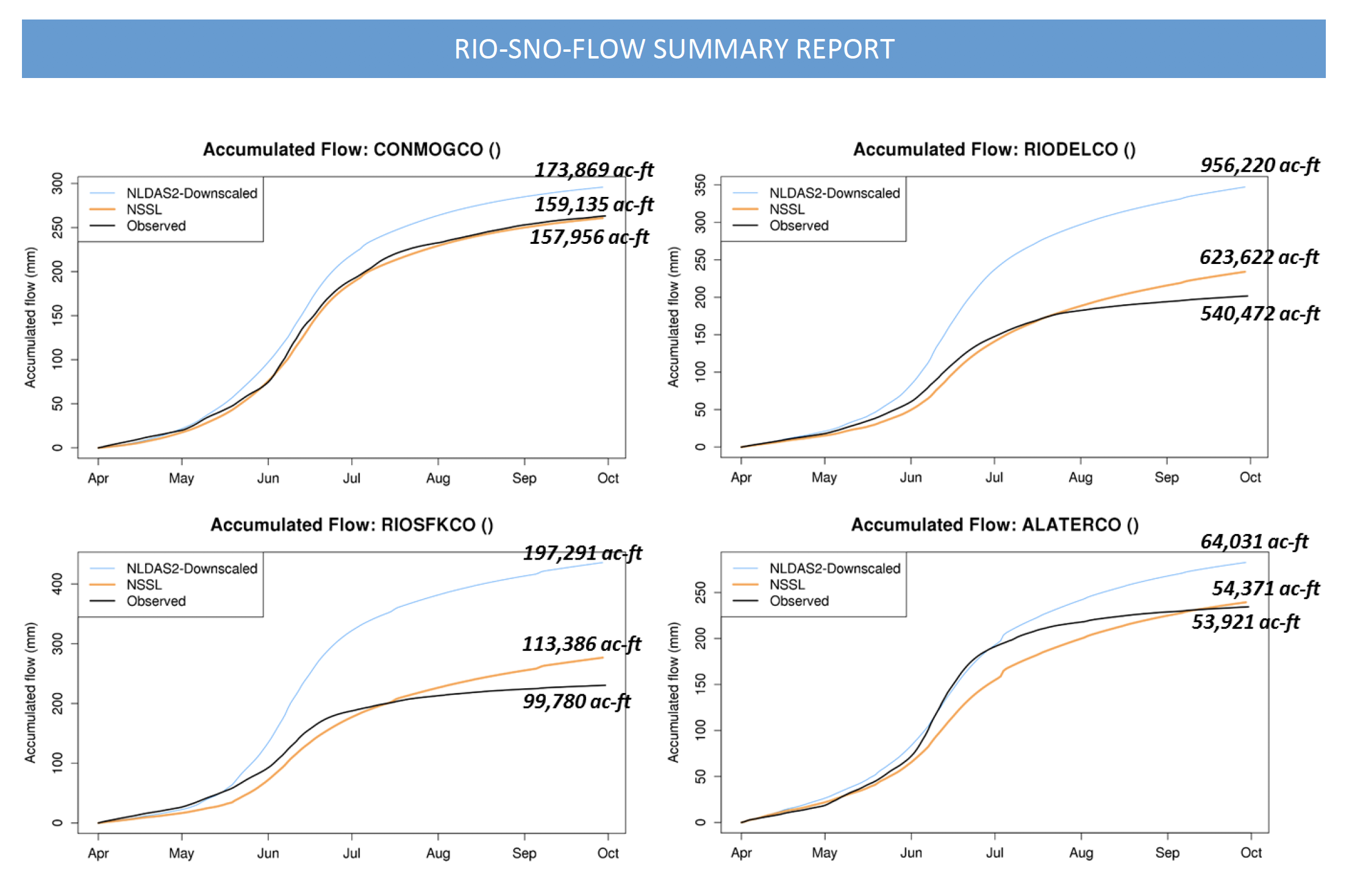
Figure 36, on page 49 of the January 2016 Report is a collection of graphs depicting data from 4 separate existing measuring points along the Upper Rio Grande River, measuring accumulative stream flows in Acre Feet. The Light Blue Line depicts Forecasted Stream Flows using existing methods. The Orange Line depicts Forecasted Stream Flows using the data from temporary radar and improved NCAR Software. The Black Line depicts that Actual Measured Stream Flows. It is clear that using the radar and NCAR Model produced better forecasts.
727 N 1550 E Suite 125
Orem Utah 84097